Difference between revisions of "Measurements"
| (7 intermediate revisions by one user not shown) | |||
| Line 2: | Line 2: | ||
<br> | <br> | ||
<br> | <br> | ||
| − | In many cases it is | + | {| width=675px |
| + | | | ||
| + | In many cases it is difficult to record the exact position of a cell tower because it is not visible, or not accessible. | ||
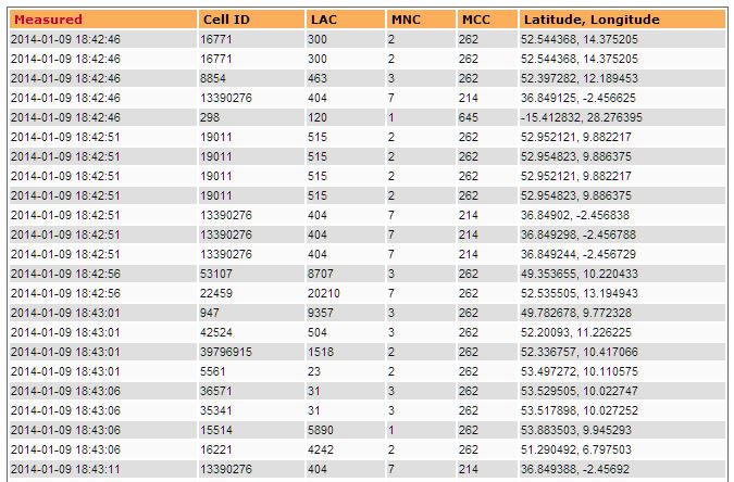
Therefore OpenCellID has chosen the approach to record as many as possible [http://en.wikipedia.org/wiki/Gps GPS] positions where the radio signal of a certain GSM cell tower can be received. | Therefore OpenCellID has chosen the approach to record as many as possible [http://en.wikipedia.org/wiki/Gps GPS] positions where the radio signal of a certain GSM cell tower can be received. | ||
| − | Each GPS position consists of a [http://en.wikipedia.org/wiki/Latitude latitude] value and a [http://en.wikipedia.org/wiki/Longitude longitude] value | + | Each GPS position consists of a [http://en.wikipedia.org/wiki/Latitude latitude] value and a [http://en.wikipedia.org/wiki/Longitude longitude] value. |
| − | The average value of all recorded latitude values | + | The average value of all recorded latitude values is computed and used for the latitude of the cell tower.<br> |
The average value of all recorded longitude values is computed and used for the longitude of the cell tower. | The average value of all recorded longitude values is computed and used for the longitude of the cell tower. | ||
| − | Then the computed latitude and the computed longitude are used for creating the GPS position of the cell tower. | + | Then the computed latitude and the computed longitude are used for creating the computed GPS position of the cell tower. |
| − | Due to the way how the data is generated this computed GPS position of a cell tower is not 100% precise. Anyhow in many cases it is | + | Due to the way how the data is generated this computed GPS position of a cell tower is not 100% precise.<br> |
| + | Anyhow in many cases it is pretty ok to be used for GSM cell tracking. | ||
| + | |} | ||
Latest revision as of 00:15, 13 January 2014
|
In many cases it is difficult to record the exact position of a cell tower because it is not visible, or not accessible. Therefore OpenCellID has chosen the approach to record as many as possible GPS positions where the radio signal of a certain GSM cell tower can be received. Each GPS position consists of a latitude value and a longitude value. The average value of all recorded latitude values is computed and used for the latitude of the cell tower. Then the computed latitude and the computed longitude are used for creating the computed GPS position of the cell tower. Due to the way how the data is generated this computed GPS position of a cell tower is not 100% precise. |
